 Tofino City Guide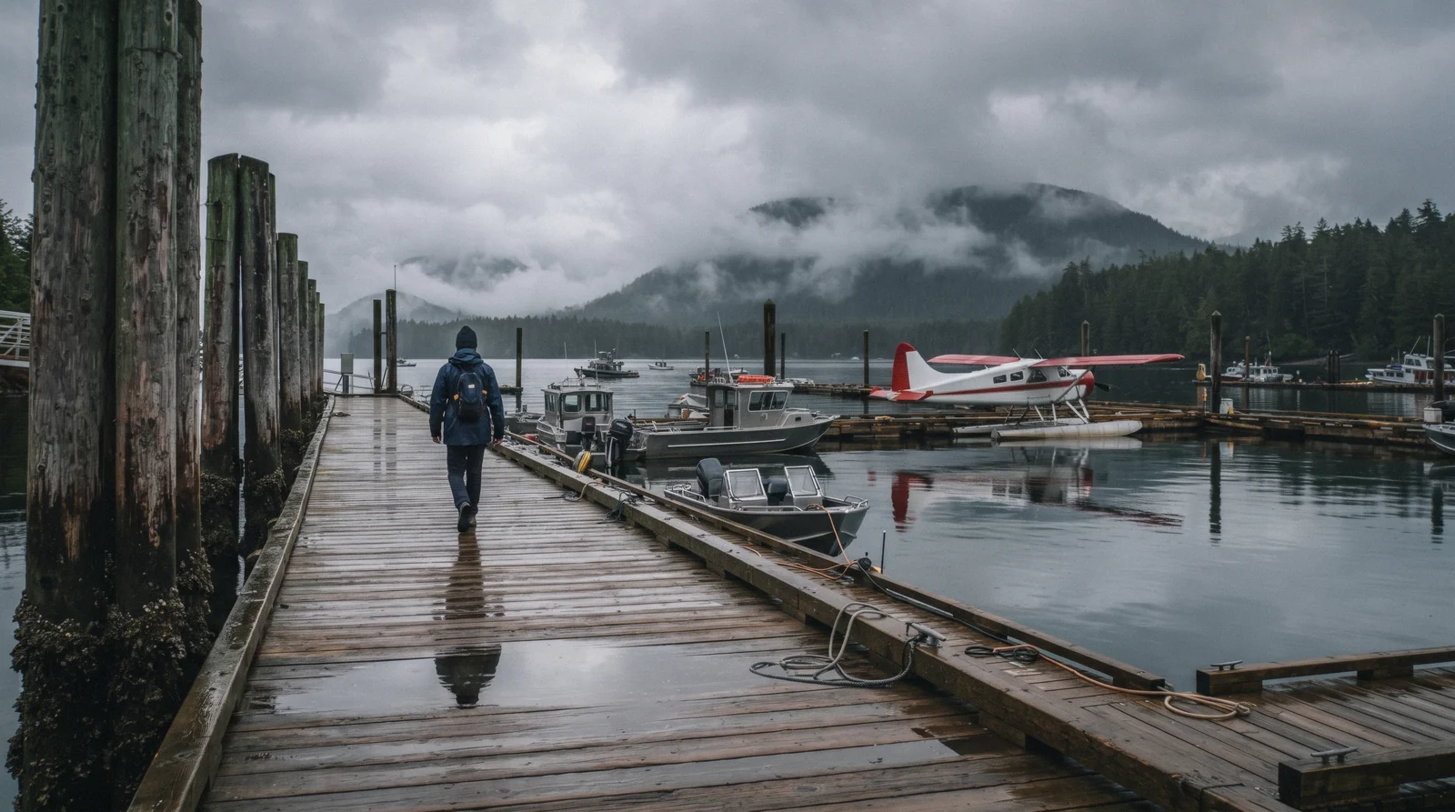
Tofino Map: Town, Park, Beaches and the Boat-Only Places
This Tofino map covers a town at the tip of the Esowista Peninsula, the end of Highway 4, with open Pacific coast on one side and the calmer inlets of Clayoquot Sound on the other. It plots that geography in four colours: downtown, Pacific Rim National Park Reserve, the free beaches outside the park, and the places reachable only by boat or floatplane. That last group cannot really be plotted to scale next to downtown, since they sit well offshore or up the coast, so the map notes each one's approximate direction and the page text carries the rest. For the full list behind each pin, see things to do in Tofino or the Tofino homepage; for the beaches specifically, Tofino beaches.
Quick answer How Tofino's geography actually breaks down
This Tofino map has pins in four colours: blue for downtown, green for Pacific Rim National Park Reserve (day pass needed), orange for the free beaches outside the park, and purple for the boat-only places like Hot Springs Cove and Meares Island. Downtown and the park sit within about a 20-minute drive of each other; the boat-only places are a further trip by water.
Key takeaways
- The green pins around Long Beach need a US$8.69 (C$12.25) park day pass; every other colour is free to reach.
- The purple pins, Hot Springs Cove and Meares Island, are not reachable by road at all, only by tour boat.
- Tonquin Beach is the only beach pin walkable from downtown without a car.
The Map
Pins plotted from OpenStreetMap coordinates, in four colours. Blue is downtown Tofino, green is Pacific Rim National Park Reserve, orange is the free beaches outside the park, and purple marks the boat-only places, shown at an approximate bearing since their true distance would push them off the frame at this zoom.
Downtown Tofino 4 pins
- Tofino HarbourFree to visitWhere the whale-watching, bear-watching and Hot Springs Cove boats load. Most tour check-ins run through the Marine Adventure Centre here.
- Roy Henry Vickers GalleryFree to browseA longhouse-style gallery on Campbell Street, a short walk from the harbour.
- Tofino General HospitalN/A24-hour emergency care, 261 Neill Street. Emergency 911, hospital line 250-725-4010.
- Tofino-Long Beach AirportN/AFixed-wing service from Vancouver, positioned between Tofino and Ucluelet on the highway.
Pacific Rim National Park (day pass) 3 pins
- Long BeachUS$8.69 (C$12.25)About 16 km of open sand, the widest single stretch on this map. The park day pass covers the whole Long Beach Unit for the day.
- Kwisitis Visitor CentreUS$8.69 (C$12.25) (park pass)Open daily 9:30-16:30 through 12 October 2026, closed 16-25 September for a cultural observance.
- Rainforest TrailUS$8.69 (C$12.25) (park pass)Two 1 km boardwalk loops through old-growth spruce and hemlock, the easiest big-tree walk on the peninsula.
Free beaches outside the park 4 pins
- Tonquin BeachFreeA short boardwalk from downtown to a small cove with rock outcrops and tide pools, the nearest beach to town.
- Chesterman BeachFreeA crescent split in two by Frank Island, which becomes a walkable spit at low tide.
- Cox BayFreeOpen, south-facing swell, the beach most surf schools favour for lessons.
- MacKenzie BeachFreeA sheltered cove facing the calmer channel side of the peninsula rather than the open Pacific.
Boat or floatplane only 2 pins
- Hot Springs Cove (Nism̃aakqin Park)$222.00 (boat tour)Roughly 40 km up the coast, reachable only by boat or floatplane, shown here at an approximate bearing rather than true scale.
- Meares Island Big Tree TrailAbout US$28.39 (C$40) water taxiOld-growth cedar on a Tla-o-qui-aht Tribal Park island, a short water taxi from the harbour.
Shortlist: Four Pins Worth the Trip
If the map above is too much at once, these four pins carry most of a first Tofino visit's value, chosen for how much each one earns its place over the rest.
| Pin | Category | Cost | Why it is first |
|---|---|---|---|
| Long Beach | Park (green) | US$8.69 (C$12.25) | The widest, longest sight on the whole map, and the day pass covers everything else in the park unit too |
| Tofino Harbour | Town (blue) | Free | Every boat tour on this site leaves from here, so it orients the whole trip |
| Tonquin Beach | Beach (orange) | Free | The only beach walkable from a downtown hotel, no car needed |
| Hot Springs Cove | Boat-only (purple) | $222.00 | The one pin on this map no road or short walk reaches, worth planning a full day around |
Town vs Park: Two Different Trips
The blue and green pins on the map above are two separate outings, not one.
Downtown Tofino, the blue pins, is walkable: the harbour, the gallery and the hospital sit within a few blocks of each other. Pacific Rim National Park Reserve, the green pins, is a drive south, and every green pin on this map needs the US$8.69 (C$12.25) day pass to be on that ground at all, even for the free-standing Rainforest Trail. Treat these as two different outings on two different days rather than one loop, since the park unit alone can fill an afternoon.
North and South of Downtown
The orange beach pins split by which side of town they sit on.
Tonquin Beach sits north of downtown, walkable. South of downtown, Chesterman Beach, MacKenzie Beach and Cox Bay string along the road toward the park boundary, each a short drive apart. A visitor without a car is limited to Tonquin on foot; anyone with a car or a bike can string the southern three together in an afternoon before crossing into the park itself for Long Beach.
What the Map Cannot Show: Boat-Only Places
The purple pins are not to scale, and that matters.
Hot Springs Cove and Meares Island are plotted at an approximate bearing rather than a precise, to-scale distance, because doing so accurately would push Hot Springs Cove well off the edge of a map still legible for downtown Tofino. Both need a boat: Meares Island a short water taxi run at about US$28.39 (C$40), and Hot Springs Cove a half-day tour at $222.00. Neither has a walking or driving route, which is the single fact this map cannot show at any zoom level.
What Is Not on This Map, and Why
A handful of things people look for on a Tofino map are deliberately left off this one.
Hotels are not pinned here. Instead, where to stay in Tofino groups accommodation by area with its own map, since a hotel pin mixed into a sightseeing map crowds out the sights and hotel choice deserves its own comparison rather than a single dot. Restaurants are not pinned either, since only a handful of Tofino venues (covered on where to eat) are citable against an independent source, and pinning the rest would mean printing names this site cannot back up.
Ucluelet's own sights, the Wild Pacific Trail and Ucluelet Aquarium, sit far enough south that they get their own map on the day trips page rather than crowding this one at a scale that still reads clearly for Tofino itself.
Distances and Parking, Pin to Pin
Once you start driving between the pins on this map, the practical pattern is simple. The town pins sit close together and are walkable. The beach corridor pins all sit south of downtown along the same highway, in sequence. The park pins sit furthest south and need a pass.
Pin to Pin, Practically
Start from the harbour and work outward. Tonquin Beach is the one beach pin you can reach on foot from downtown. The three southern beach pins each have their own access lot and are reached by separate short turns off the same road.
The park pins are a further drive south, past the airport, and the pass rules change once you cross the park boundary. For the airport pin, check your own map app for current drive time rather than trusting any single published figure.
| From | To | How |
|---|---|---|
| Tofino Harbour | Tonquin Beach | Walking distance from downtown via the Tonquin Trail. No car needed. |
| Downtown Tofino | Chesterman Beach, MacKenzie (tinwis) Beach, Cox Bay | Short drive south along the same road. Each beach has its own separate parking lot. |
| Downtown Tofino | Long Beach and Pacific Rim National Park | Drive south toward Ucluelet. A park day pass is required once inside the park boundary. |
| Downtown Tofino | Tofino-Long Beach Airport | The airport sits between Tofino and Ucluelet on the Pacific Rim Highway. Sources disagree on the exact distance, so check your own map app for current drive time. |
Two Different Parking Fees
This is the detail that catches visitors out. The green park pins are covered by one fee, the Pacific Rim National Park day pass, which pays for the park unit only. That pass does nothing for the orange beach pins.
The beaches outside the park, at Chesterman, MacKenzie (tinwis), Cox Bay and Tonquin, are free to visit, but the District of Tofino meters the access lots. Parking there costs US$2.13 (C$3.00) per hour or US$10.65 (C$15.00) per day, enforced from 08:00 to 23:00. So if your day includes both Long Beach and Chesterman Beach, expect two separate parking costs.
See our Pacific Rim park pass page for the park side of this, and our Tofino beaches pages for the lots themselves.
Parking rates from the District of Tofino. Park pass details from Parks Canada.
Reading This Map Without a Car
You do not strictly need a rental car to use this map, but reach changes a lot without one.
Which Pins You Can Actually Reach
On foot, you can cover the blue town pins and Tonquin Beach, which connects to downtown by a short trail. The beach corridor to the south is partially covered by the West Coast Transit local bus. The adult single fare is US$3.55 (C$5.00) and the DayPASS is US$7.10 (C$10.00).
The purple boat-only pins need no car at all, since you reach them by water either way. That leaves the park pins as the awkward ones without wheels. Our getting around Tofino guide compares every option in detail, and car rental or bike rental are the two standard ways to extend your reach to the full set of pins.
The 25 km paved pathway through the park also links the corridor for cyclists.
Fares from BC Transit West Coast Transit.
One Safety Note This Map Cannot Show
A pin on a map tells you where something is. It cannot tell you how supervised it is.
No Lifeguards, and Leash Rules in the Park
There have been no lifeguards on any beach in the Tofino area since 2012, at the town beaches and inside the national park alike. A pin on this map is not a claim that a beach is supervised. If you bring a dog, Pacific Rim National Park requires dogs on a leash at all times, everywhere inside the park boundary, including beaches, trails, parking lots and the water.
Our Tofino Safety page covers rip currents, cold water and wildlife basics.
Lifeguard status per the District of Tofino and Parks Canada. Leash rule per Parks Canada.
Where to Go Next
The pages behind each colour on the map, or back to the Tofino guide's front page for the overview.
Things to Do in Tofino
The full list behind every pin. See things to do.
Tofino Beaches
All the orange pins, compared in detail. See the beaches.
Pacific Rim National Park
What the green pins' day pass actually covers. Read the park guide.
Getting Around Tofino
How to move between the pins without a car. See getting around.
Tofino Tours
Every boat that reaches the purple pins. Compare the tours.
Tofino Map: Questions
What is so special about Tofino?
Its position at the end of a single highway, with open Pacific surf beaches on one side and the sheltered inlets of Clayoquot Sound on the other, all within a short drive or boat ride, as this map shows.
How far is downtown Tofino from Long Beach?
Long Beach sits inside Pacific Rim National Park Reserve, a drive south of downtown along the same highway that continues to Ucluelet. See the green pins on the map above for the park boundary relative to town.
Which places on the Tofino map need a boat?
The purple pins: Hot Springs Cove and Meares Island's Big Tree Trail. Neither has a road or a walkable route from downtown.
Is there a walking map of downtown Tofino?
The blue pins on this map (harbour, gallery, hospital) sit within easy walking distance of each other. For beaches on foot, only Tonquin Beach, north of downtown, is walkable without a car.
Do I need a car to see everything on this map?
For the green (park) and most orange (beach) pins, yes, or a bike on the connecting road. The blue town pins and Tonquin Beach are walkable, and the purple pins need a boat regardless of whether you have a car.
Is there parking at the beaches on this map?
Yes, at the Chesterman, MacKenzie (tinwis), Cox Bay and Tonquin access lots. The District of Tofino meters these lots at US$2.13 (C$3.00) per hour or US$10.65 (C$15.00) per day, enforced from 08:00 to 23:00. This is separate from and in addition to the Pacific Rim National Park day pass, which covers only the park unit at Long Beach and Rainforest Trail, not the town beaches.
Can I get between the pins on this map by bus?
Partly. The West Coast Transit local bus runs the town and beach corridor. The adult single fare is US$3.55 (C$5.00) and the DayPASS is US$7.10 (C$10.00). The boat-only pins need no bus since you reach them by water. For the full route picture and what to do about the park pins, see our getting around Tofino guide.
Are Tofino's beaches on this map supervised?
No. There have been no lifeguards on any Tofino-area beach since 2012, at the town beaches and inside Pacific Rim National Park alike. Swim and surf with that in mind, watch for rip currents, and read our Tofino Safety page before you go. Note also that dogs must be on leash everywhere inside the park boundary.
Tofino on Film
Three video overviews that help with orientation before a first visit.
WATCH THIS BEFORE YOU GO TO TOFINO, BRITISH COLUMBIA! (4 day Tofino itinerary)
A four-day itinerary that moves between the town, park and beach pins on this map.
Video: Jake & MarieThe Don'ts of Vancouver Island | Important Things You Need To Know
Practical orientation notes for the wider island, useful context for a Tofino-based trip.
Video: ADVENTURE CAMPitelliUcluelet and Tofino: the ONLY TRAVEL GUIDE you'll need!
A combined guide showing how Tofino's layout connects to the wider peninsula.
Video: Alex & MJVideos load from YouTube only when you press play.
We may earn a commission if you book through one of our links, at no extra cost to you. Full affiliate disclosure